On a clear and sunny day in Autumn 2016 Border Archaeology flew a drone over Stobs Camp and captured many of the PoW camp’s features using aerial photography.
Looking North East these pictures clearly show C camp and D camp. The former narrow gauge railway line can be seen on the left.
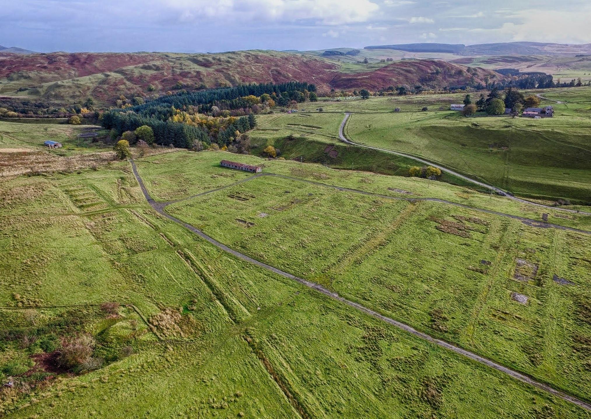
Stobs PoW Camp looking North East showing C Camp and D Camp
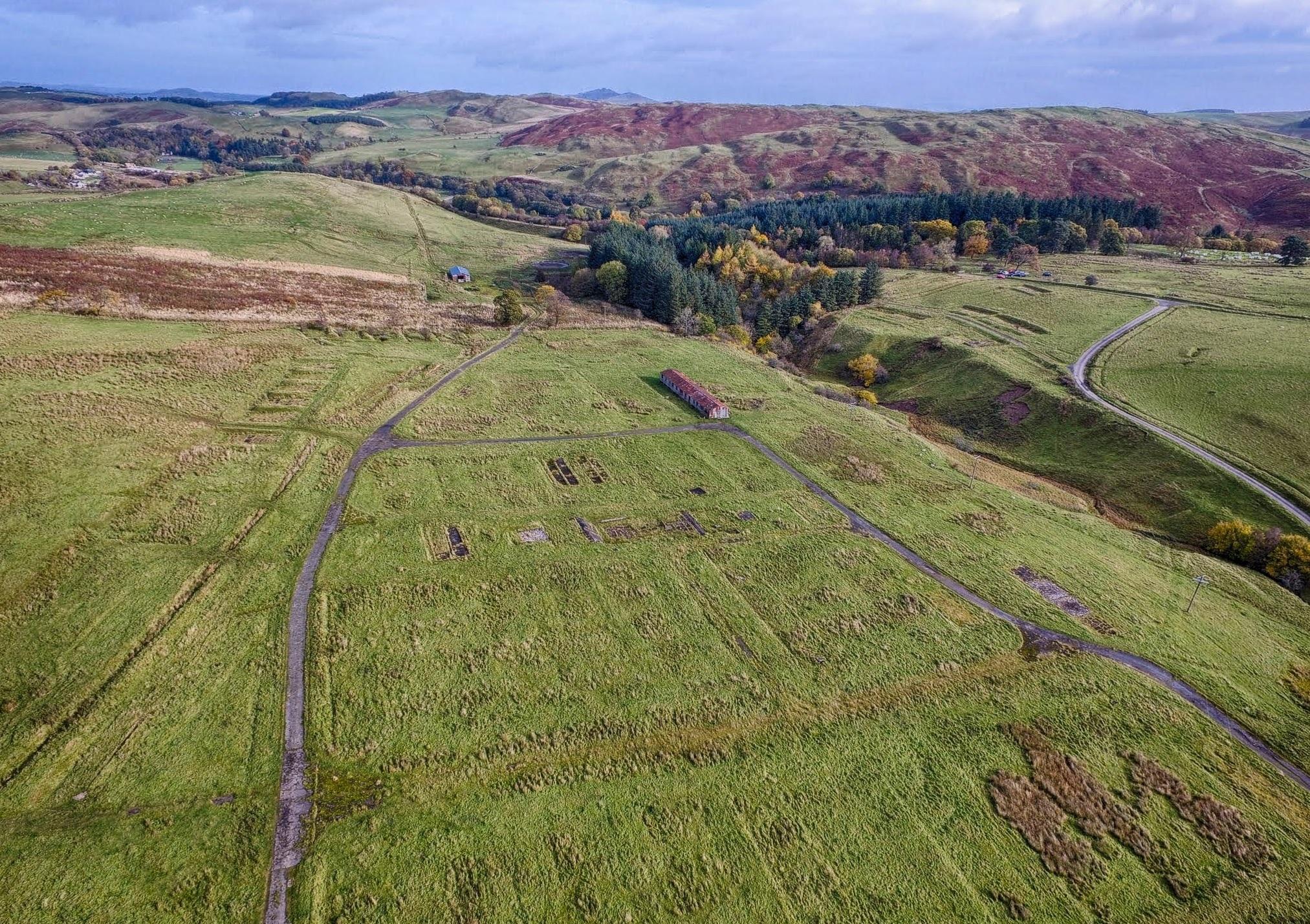
Stobs PoW Camp looking North East showing C Camp and D Camp
Stobs PoW Camp looking North East showing C Camp and D Camp
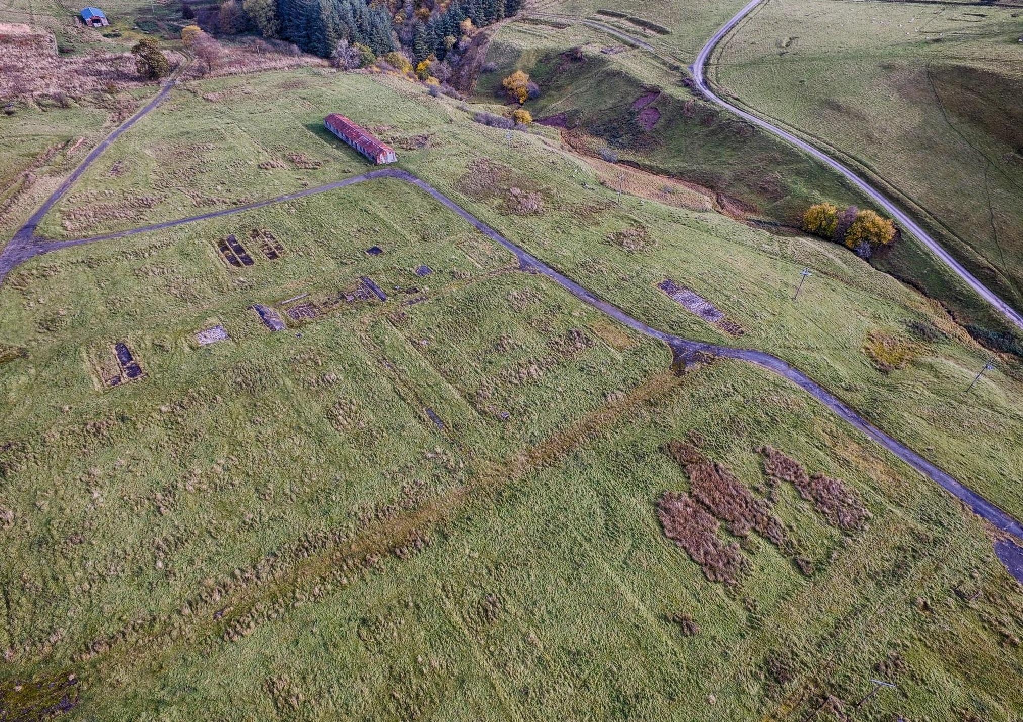
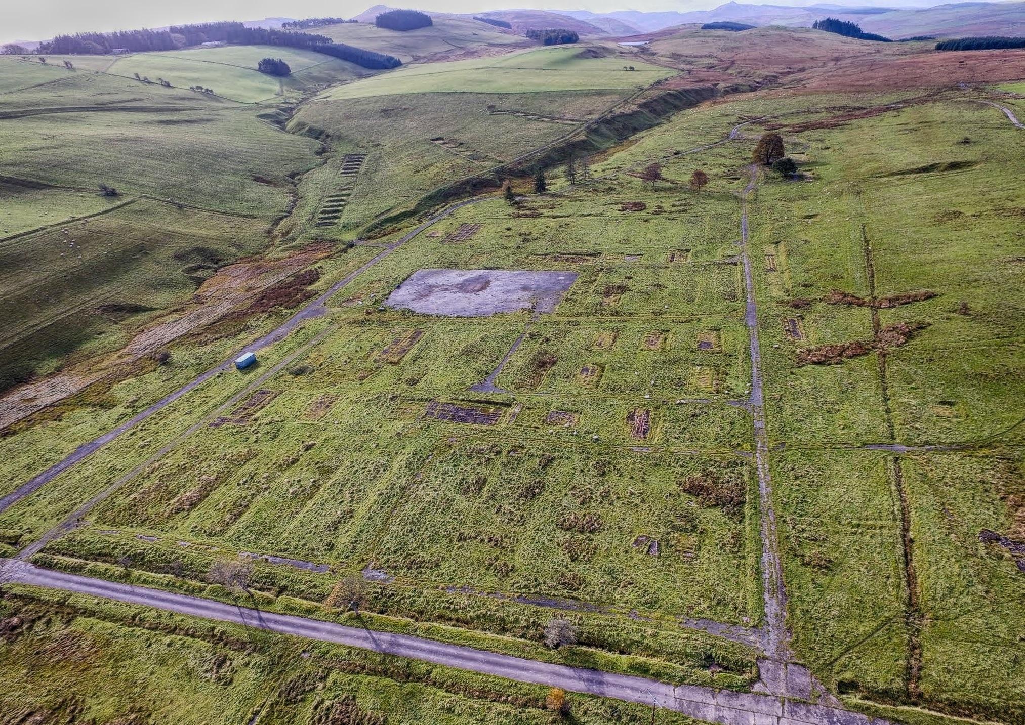
And here, looking South East, the YMCA Road separates B camp (on the right) and C Camp (on the left). Next to the concrete drying hut in the centre is the bathing pond.
Stobs PoW Camp looking South East showing B Camp and C Camp
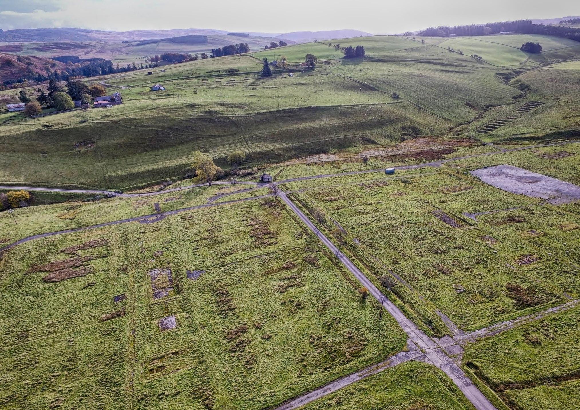
In this picture, looking South West, the YMCA Road is in the foreground and Hospital Road heads away on the left. In the centre are A Camp and B Camp and the later parade ground.
Stobs PoW Camp looking South West showing A Camp and B Camp
The project would like to thank Border Archaeology for providing these aerial images.